Everyone has their favourite model and very few of them agree
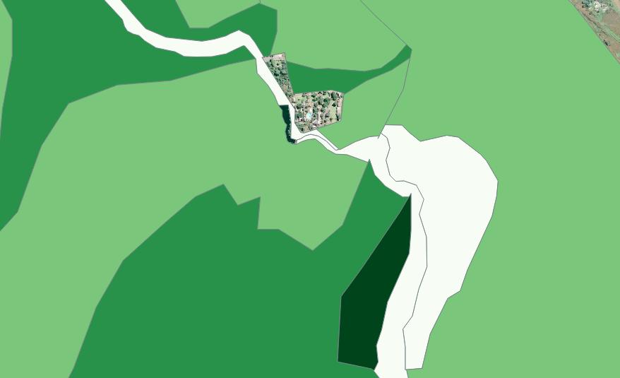
Grazing capacity maps (darker is higher grazing capacity, or fewer hectares required to support each animal)
“Grazing capacity” is not the most click-bait phrase that one would find on the internet. It probably comes somewhere between “Donald Trump’s hair” and “exciting new developments in toaster manufacturing” in public interest.
But for millions of square kilometres of the earth’s surface, grazing capacity is critically important. Grazing capacity, very simply, is the number of animals that can graze on a certain area of land for a certain period of time, generally without dying of starvation in the process, and without denuding the soil of every blade of grass.
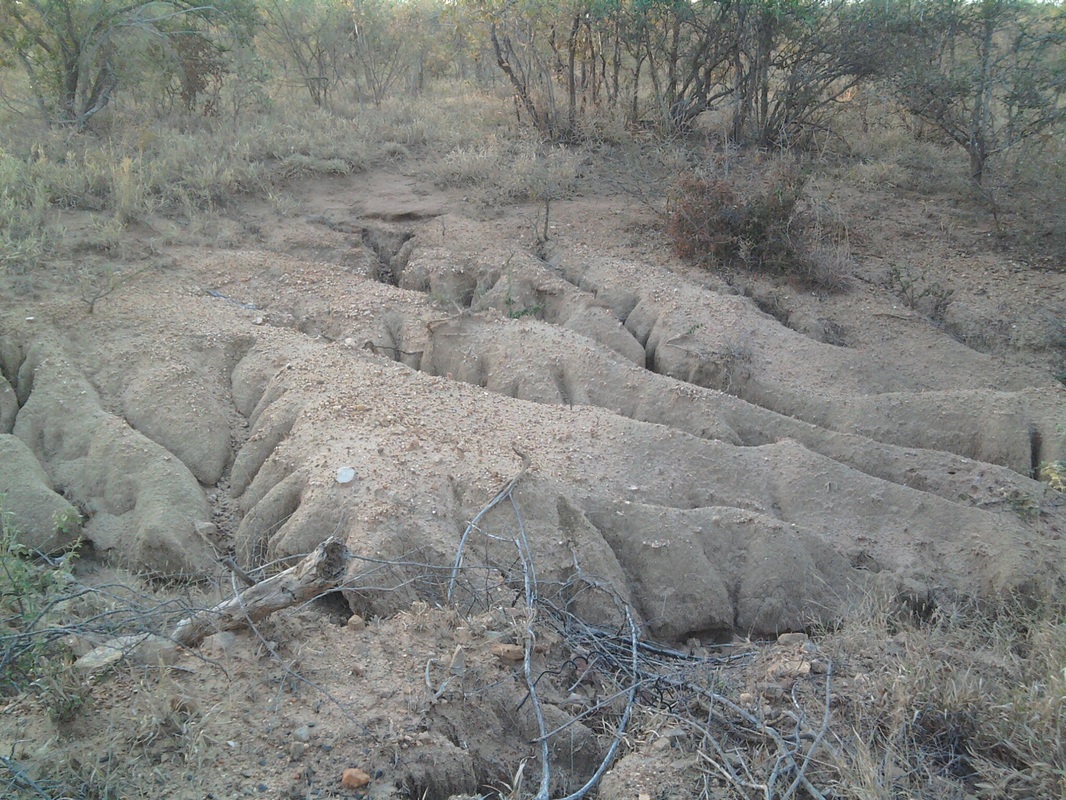
The concept of grazing capacity, therefore, implies a balancing act between the needs of the veld and the needs of the animal. The veld does usually need a certain amount of grazing, but too much and the perennial, palatable grasses start to disappear and unpalatable grasses and bare soil take their place. Weeds start to encroach, erosion gullies appear and rainwater no longer infiltrates into the topsoil to feed the roots of the remaining plants. Overgrazing, in other words, causing grazing capacity to decline in the long term, and nobody benefits. Yet we still struggle to actually measure grazing capacity.
But for millions of square kilometres of the earth’s surface, grazing capacity is critically important. Grazing capacity, very simply, is the number of animals that can graze on a certain area of land for a certain period of time, generally without dying of starvation in the process, and without denuding the soil of every blade of grass.
The concept of grazing capacity, therefore, implies a balancing act between the needs of the veld and the needs of the animal. The veld does usually need a certain amount of grazing, but too much and the perennial, palatable grasses start to disappear and unpalatable grasses and bare soil take their place. Weeds start to encroach, erosion gullies appear and rainwater no longer infiltrates into the topsoil to feed the roots of the remaining plants. Overgrazing, in other words, causing grazing capacity to decline in the long term, and nobody benefits. Yet we still struggle to actually measure grazing capacity.
Earthworms would struggle here
But at the same time, farmers have to make a living. They need to produce enough calves, or lambs, or wool or milk to turn a profit (whether they are commercial farmers farming for profit, or traditional herdsmen farming for multiple cultural reasons, they still want new calves). Which means that the farmer needs to have enough animals on the land to keep his operation successful. So he needs to find that optimal number of animals that keeps animals fat, calves appearing every season, and the veld in good working condition. The same principle applies to “natural” ecosystems – fenced off game reserves where animals are restricted from migrating to greener pastures. Overpopulation can cause a mass-die off of herbivores, and at the same time damage the veld so much that it might take years to recover.
And that balance is what we refer to as the grazing capacity of a particular area of veld (we also talk about browsing capacity, for those animals like goats, kudu and giraffe that prefer to browse on shrubs and trees rather than graze on grass, but for this discussion I’m confining myself to grazing. Pretty much everything I can say here about grazing capacity applies in spades to browsing capacity, which is far more complicated to estimate). If we have a good handle on grazing capacity, we can manage the veld better by knowing when the veld is overstocked, or when to add more animals.
The concept of grazing capacity is mostly used for planning and regulation, which is what makes good grazing capacity estimates even more important – can the department of agriculture take action against a farmer who is overstocked compared to departmental regulations, if we can’t demonstrate that the department’s estimates are reasonable?
So how do we calculate grazing capacity?
Many different ways of estimating grazing capacity have been developed over the years, and they differ widely in their assumptions and processes.
The first, and oldest, category of methods works on the principle that the long-term productivity of the veld is directly related to the species composition of the veld – that is the proportions of different species that occur in the community. Generally, the species composition of a particular site is determined by a field survey, and compared to the (often hypothetical) species composition of an “ideal”, or benchmark, site for that particular veld type. The principle is well-founded with a lot of empirical evidence to support it.
Then there are methods that look directly at the productivity of the grass – that is, how much grass can be predicted to grow on a particular area, based on rainfall and soils. Remote sensing (satellite) technology is an important development here, where the productivity can be estimated using sophisticated analytical tools.
And finally, there are methods that combine both approaches – that is, they estimate both the species composition of the veld, and the amount of grass produced, and use various models to convert those data to grazing capacity.
All of these models will take some measure of rainfall into account – usually the long-term average for the area, or the long-term growing-season average.
All of these methods have been peer-reviewed, tried and tested in the field, sometimes for decades. However, they also have the veneer of accepted wisdom. They are rarely questioned and have the authority that comes from the respected scientists that developed them and the artificial precision of their results (I’ve seen students express the results from these models with several decimal points of precision). The underlying assumptions are rarely questioned, and often are based on ecosystem models that are increasingly out of step with our current understanding of how veld ecosystems work. Most of these methods were early forays, and even their original authors described them as that – early attempts at improving our models. First attempts require second and third and fourth iterations, otherwise they simply become outdated.
For the field worker, a major challenge comes when trying to decide which method to use on a particular area. In principle, it should be straightforward – pick the method that was developed for the area in which you’re working, do the field work, run the calculations and viola! – you have a grazing capacity. But there are two problems. Firstly, some areas have not had simple grazing capacity models developed for those conditions, so people will pick one developed in another area (for example, using a model developed for the Eastern Cape in the central highveld). And secondly, for any one area there may be two or three competing models available, each with its own set of assumptions, giving different results. Mostly, the person doing the work picks the grazing capacity model that they learnt at varsity, or the one that happens to be more accessible (some models are tucked away on obscure software packages in government institutions), or the first one that they found when looking up “grazing capacity models”.
I first became aware of these competing models several years ago, working for a provincial department of agriculture. At the time, the national department of agriculture was updating its national grazing capacity map (a critical part of the agricultural regulations) using remote sensing technology and a set of analytic tools to develop a map of grazing capacities for the whole country. In KwaZulu-Natal, our department had already developed a grazing capacity map over many years of research and experience, and we weren’t satisfied with the national map. There appeared to be quite a few contradictions. So my colleagues and I extracted hundreds of field surveys from a central database, surveys which had been conducted over many years all over the province, and compared the grazing capacity estimates from those field surveys to the grazing capacity estimates from the satellite survey, for each site.
There was no correlation between the two sets of results. None. Nada.
That results were pretty surprising. Even if the two datasets didn’t agree exactly, one would expect sites with low grazing capacity on one scale to have low grazing capacity on the other scale, and the same for high grazing capacity. But that wasn’t the case.
It wasn’t that one model was better than another. It was that they were two datasets using different models, different assumptions and mapped at different scales, but both purporting to be able to predict, for a particular patch of land a few hectares in size, how many animals could be sustainably grazed.
Since then, as a consultant and advisor, I’ve had the same problem. Which model to use? Which benchmark to use as a comparison? Which assumptions to plug into the model? Should animals leave seventy percent of the grass, or sixty percent, or fifty percent, in order to allow the grass to recover after grazing? How many kilogrammes of grass are you likely to get for every millimetre of rain? How long is the growing season?
And these competing models can result in very different recommendations – say, 500 breeding cows versus 300 breeding cows on one particular farm. That can be the difference between bankruptcy and profitability. It can also be the difference between a sustainable farming enterprise, where the natural resources remain productive for decades to come, and an unsustainable farming enterprise where the natural resources are depleted within a few years.
Is it time to ditch the concept of grazing capacity?
Some commentators have suggested that trying to estimate fixed, long-term grazing capacities which apply for all situations is meaningless.
First of all, drier parts of the world – the semi-deserts and low-rainfall savannas – are known for one thing, and that is that nothing is stable. The rainfall varies enormously from year to year, from crippling droughts to abundant water, and the veld responds to that rainfall like a four-year-old to a sugar rush. One year there’ll be almost no grass, and the next there’ll be more than you know what to do with (I’m simplifying, but that’s the basic principle). So the grazing capacity will vary enormously from season to season. (In the wetter parts of the world - in southern Africa, the eastern escarpments and coastal areas - the rainfall doesn’t vary as much, and the grass production is relatively constant from year to year).
Secondly, you can’t talk about grazing capacity without taking into account the objectives of the land users. So commercial farmers want fatter animals producing more milk and meat and calves, whereas traditional herdsmen are not as concerned about productivity of the animals and are more concerned with keeping reasonably stable herd numbers over time. Game farmers might want large numbers of animals for eco-tourism, or small numbers of trophy animals for hunting. All of these objectives have different optimal grazing capacities.
But that doesn’t help the planner. Drawing up policies, or a plan for a particular community or game farmer or cattle rancher, without having some idea of how many animals can be carried without causing long-term damage to the veld and long-term decline in animal production, makes it very difficult to make any plans.
“What sort of turnover can be expected from this operation?”
“Well, it depends on how many animals you can keep”.
“OK. How many animals can I keep?”
“Weelllll. That depends”.
Not very helpful to anyone, least of all the advisor’s reputation.
Roughly right
Barry Smith is a farming advisor and extension officer with decades of experience in southern Africa. He published a fantastic set of guidelines, rules of thumb and advice for farmers and advisors, which I use as one of my standard references. His most important rule was that it is “better to be roughly right than precisely wrong”.
That’s a sentiment with which I heartily concur. You have to start somewhere. As long as the land-user follows basic common-sense rules of adaptive management (keeping an eye on operations, and his veld, and adapting his management if his goals are not being met) then the initial grazing capacity estimation becomes merely a starting-point in a process of improvement.
But at the same time, the proliferation of models and rules for estimating grazing capacity is not helpful. It’s time we had a good hard look at what models and approaches actually work, and which ones we need to abandon.
It’s about the grass
First of all, we need to ditch the “grazing capacity” (number of animals) aspect of these models and start focussing on the forage production side – the amount of grass. Once we have an idea of forage production, we can decide what the appropriate grazing capacity will be for a specific objective. We can do this because we have a pretty detailed understanding of animal nutrition and physiology. We also have a pretty good understanding of plant physiology. At the moment, the productivity of the grass and grazing capacity of the veld are entangled in some of the models – that is, the final result is expressed in grazing capacity, without any way to separate out the productivity part of the equation.
I’m fairly optimistic about the use of technology to assist this process. We’ve made huge strides in the last two decades in remote sensing technology, as well as in the tools and algorithms used to analyse the raw data and convert it to something useful. But most of these tools remain inaccessible to the public – they require sophisticated software, vast amounts of raw data (some of which is not cheap) and years of training to develop the skills needed process the data. So if we can package the results of these tools into useful apps and simple decision-support tools for farmers and advisors, we could start standardising the many disparate models that currently exist.
Of course, the problem then becomes, how accurate are these models? As the story I gave earlier illustrates, the department of agriculture tried to do exactly that, and developed a grazing capacity map for the country which disagreed with the results from a different model.
Nonetheless, the user-friendly app approach has the advantage that models can be constantly tweaked and updated behind the scenes, as new research improves our understanding of system processes. The department of agriculture map was a starting point, but it can be continually improved. Using high-resolution satellite imagery, we can start providing better estimates of grass production at much finer scales – scales that are useful to the farmer as much as to the policymaker. And once we have an estimate of grass production, we can set our grazing capacity according to our objectives, rather than working from a fixed, one-size-fits-all approach to grazing capacity.
Grazing capacity has been a staple of grassland science research and thinking for decades. As I’ve said before, though, livestock and game farmers are ultimately grass farmers. Think of grass as the crop. Every other crop in agriculture is expressed in productivity units – tonnes per hectare. Saying that your grass production has declined from 2000 kg per hectare to 1600 kg per hectare is far more understandable than saying the veld grazing capacity has declined from 3.7 hectares per animal to 4.6 hectares per animal (yup, the larger number of hectares needed to feed each animal means a decline in grazing capacity).
In the example I just used, the calculated grazing capacity depended on at least three hidden underlying assumptions, and tweaking any of them would cause significant changes to the result. I could change the amount of grass required by each animal every day (set at 10 kg per day). I could change the proportion of available grass grazed by each animal (set at 50%). And I could change the number of days that I want to graze the animals on the veld from the whole year (365 days) to a few months.
In fact, let’s try that out. I’ll change the amount of forage required by each animal daily to 12 kg (used in some literature). I’ll change the proportion of forage consumed to 40% (used in some literature). And I’ll keep the grazing period the same. The result? On 2000 kg per hectare grass production, and a 2000 hectare farm, the first set of assumptions says the farmer can carry 548 animals. The second set of assumptions says the farmer can carry 365 animals. That’s a difference of 183 animals, or one third fewer animals. On the same amount of grass.
If farmers are given direct estimates of grass productivity, then any further assumptions about how to use that grass become explicit and specific to the situation of that farm. But if the model simply spits out a grazing capacity in numbers of animals, it should raise a lot of questions.
I think farmers can easily and intuitively understand the tonnes per hectare of veld and incorporate that into their planning, and it will give them the flexibility that is required to adjust animal numbers rapidly as conditions change.
 RSS Feed